【R】sabre
2021年7月12日
1. はじめに
sabre(Spatial Association Between REgionalizations)は、2つの地図の関係を計算してくれるパッケージです。
2. インストール
CRANからインストールできます。
install.packages("sabre")3. つかってみる
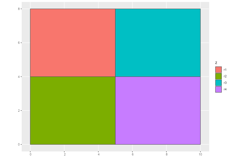
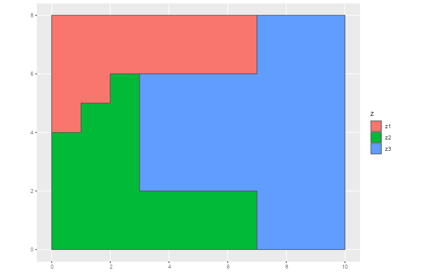
このような2つの地図データがあったとします。
library(sabre)
library(sf)
library(tidyverse)
library(ggplot2)
data("regions1")
data("regions2")

regions1 %>%
  ggplot(aes(fill=z)) +
  geom_sf()
regions2 %>%
  ggplot(aes(fill=z)) +
  geom_sf()
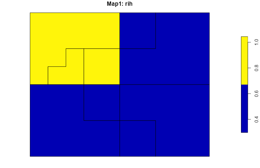
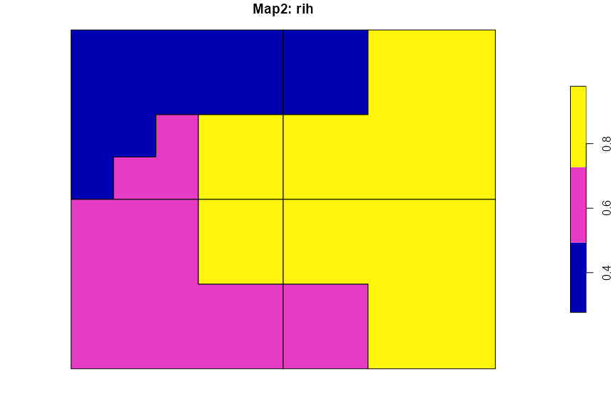
これらを計算して結合すると
regions_vm = vmeasure_calc(x = regions1, y = regions2, x_name = z, y_name = z)

plot(regions_vm$map1["rih"], main = "Map1: rih")
plot(regions_vm$map2["rih"], main = "Map2: rih")
4. さいごに
地図上にいろんな情報を重ねられていいですね。
