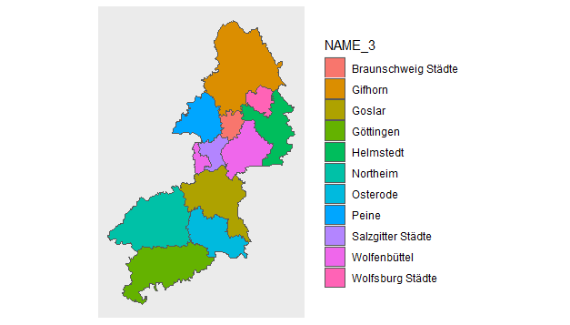
【R】Braunschweigの地図
2020年8月14日
こちらでは、ドイツ全体の地図を描きました。
今度は、ドイツの一部の地域の地図をシェープファイルから抽出して描いてみます。例として、Niedersachsen州のLandkreisであるBraunschweigを描いてみます。
こちらと同じドイツ(DEU)データをとってきて、今度は、
DEU_adm3.shp
ファイルを使用します。
library(ggplot2)
library(sf)
library(tidyverse)

  map <- read_sf("shp_world/DEU_adm3.shp")

map %>%
  filter(NAME_2 == "Braunschweig") %>%
  ggplot() +
  geom_sf(aes(fill = NAME_3)) +
  coord_sf(datum = NA)