【R】ggspatial
2020年12月19日
1. はじめに
ggspatialは、ggplotでspatial data を簡単に扱えるようにしてくれるパッケージです。sf, sp, rasterに対応しています。
2. インストール
CRANからインストールできます。
install.packages("ggspatial")3. 使ってみる
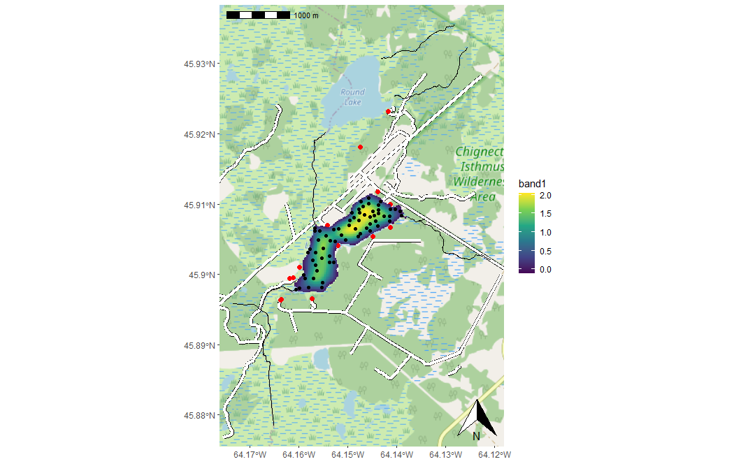
library(ggplot2)
library(ggspatial)

load_longlake_data()

ggplot() +
  annotation_map_tile(zoomin = -1) +

  annotation_spatial(longlake_roadsdf, size = 2, col = "black") +
  annotation_spatial(longlake_roadsdf, size = 1.6, col = "white") +
  annotation_spatial(longlake_buildingsdf, size = 2, col = "red") +

  layer_spatial(longlake_depth_raster, aes(colour = stat(band1))) +
  scale_fill_viridis_c(na.value = NA) +

  layer_spatial(longlake_depthdf, aes(fill = DEPTH_M)) +
  layer_spatial(longlake_streamsdf) +

  annotation_scale(location = "tl") +

  annotation_north_arrow(location = "br", which_north = "true")
4. さいごに
簡単にきれいに描画できるなあ。
